
Sunday, 3rd October 2010
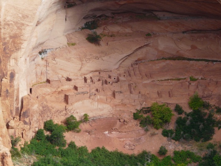
Soon After leaving Kayenta we branched off the main road to visit the Navajo National Monument. We followed the Sandal Walk to the overview of the Betatakin ruins, built in an enormous alcove measuring 452 feet high and 370 feet across between 1267 and 1286. Branching off the Sandal Trail, we followed the Aspen Trail to view a "relict forest," in this case a stand of quaking aspen on the canyon floor.
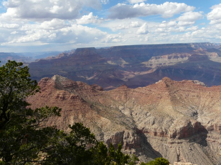
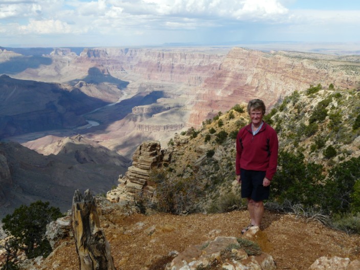
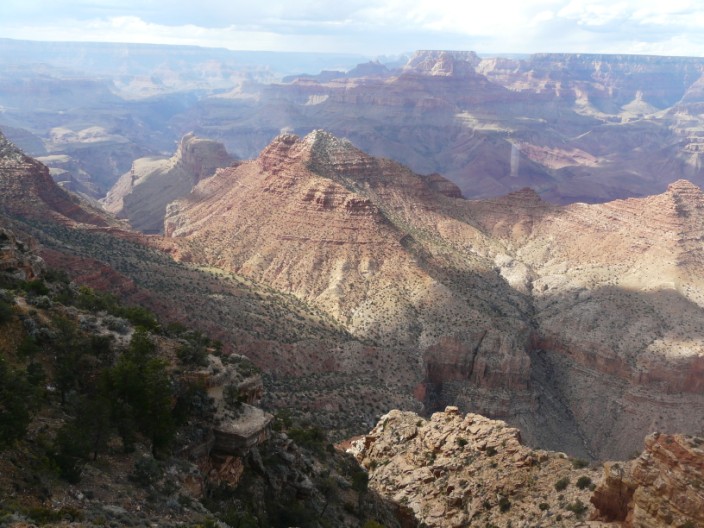
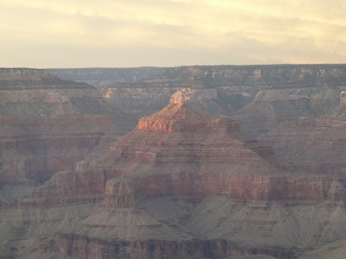
We then continued on to Desert View for our first sighting of The Grand Canyon. Many photos later, we visited Desert View Tower, opened in 1933 and built by Mary Jane Colter. A perfectionist, Colter scrutinized every detail, down to the placement of nearly every stone. Each stone was handpicked for size and appearance. Weathered faces were left untouched to give the tower an ancient look.
To finish off the day we visited a quiet spot overlooking the Canyon to watch the sunset.
Navajo National Monument features well-preserved ruins of villages left behind about 1300 by prehistoric Pueblo Indians -- the Kayenta Anasazi. Built and occupied for only 50 years, the ruins represent the final settlement of farmers who adapted to the area's scarce rainfall to grow crops, build houses and raise families, then mysteriously move on.
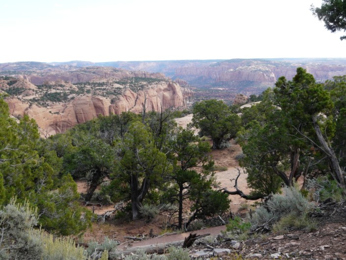
The Sandal Trail provides views of the spectacular canyonlands and ends at an overlook of the Betatakin ruins across the 560 feet deep Betatakin Canyon. Betatakin was built in an enormous alcove measuring 452 feet high and 370 feet across between 1267 and 1286. The Aspen Trail branches off Sandal Trail to descend 300 feet to view ancient aspen forest.
Desert View offers the first glimpse of the Grand Canyon for visitors
arriving from the east, and presents a spectacle rather different to most
overlooks as one third of the panorama is of the flat plains of the Painted
Desert, on the east side of the Colorado as it bends round to the north. The
park road cannot follow the rim any further east as the ground falls away
steeply towards Cedar Canyon, a tributary of the Little Colorado River, so the
many other viewpoints are all found to the west. The land to the east is still
accessible by trail, however.
Time to explore . . .
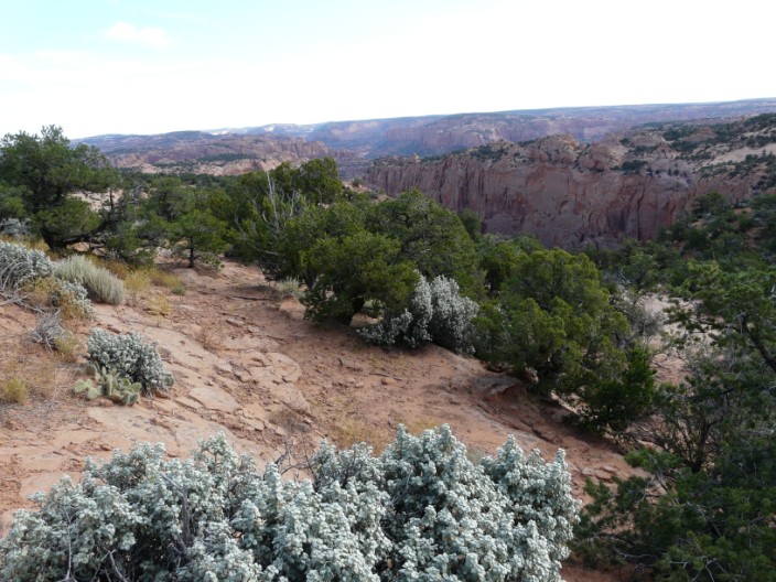
with views from the outlook . . .
giving a taste of what is to come
The Sandal Trail ends with a view of . . .
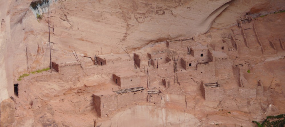
the Betatakin ruins . . .
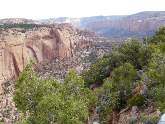
in the Betatakin Canyon, a branch off the Tsegi Canyon

The Aspen Forest Overlook . . .
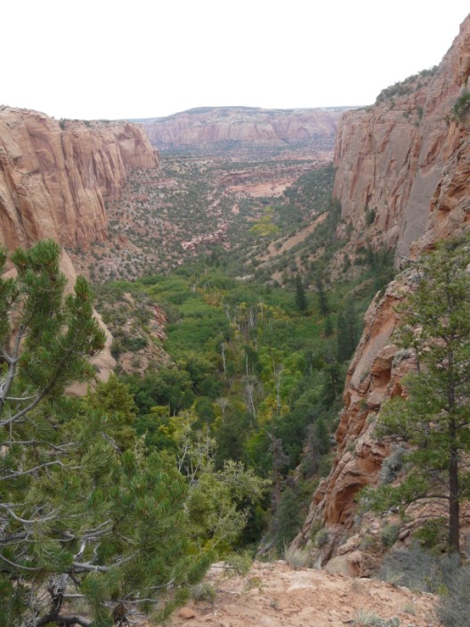
reveals a relict forest where a quaking aspen grove graces the forest floor and the north-facing cliff (right) offers shady habitat for towering Douglas Fir

Near the visitor centre . . .

is an interesting display!
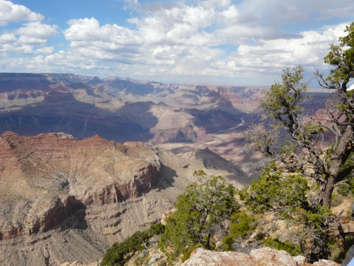
Desert View Overlook where the Colorado can be seen heading in a northerly direction . . .
and looking north-west
From a new vantage point . . .

more views of the Colorado
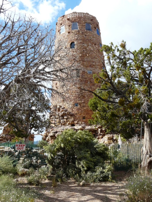
Desert View Watchtower . . .
with views to the west . . .

and to the north
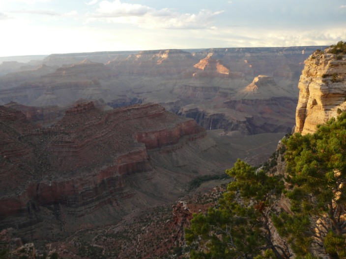
As the sun starts to set . . .

we make the most of the special light . . .
and watch the colours change . . .
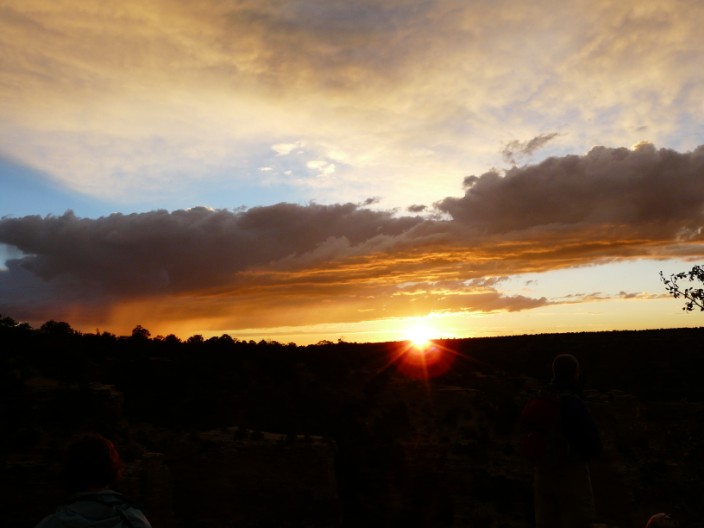
as the sun sinks . . .
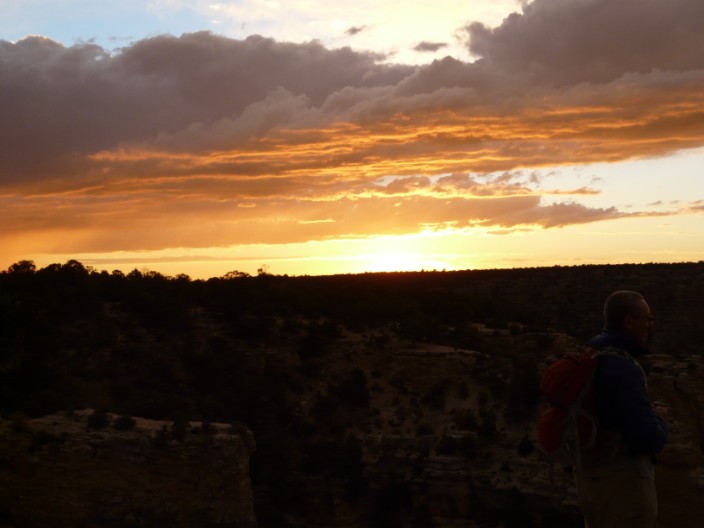
below the horizon . . .

to disappear altogether