Tuesday, 28th September 2010
After a brief stop to look at the Moab Fault we continued on to Balanced Rock where we enjoyed a short circular walk to take in its varying faces. Then it was on through Arches National Park to Devils’ Garden. Here our route took us along constructed pathways and over slickrock, with diversions to the various arches along the way. Only 2 years ago Wall Arch collapsed as the rain and ice eventually took its toll. Similarly, in 1991 a rock slab 60 feet long, 11 feet wide and four feet thick fell from the underside of Landscape Arch, leaving an even thinner ribbon of rock.
A brief return to the hotel was followed by a visit to Dead Horse Point towering 2,000 feet above the Colorado River. Legend tells that in the 1800s, cowboys used Dead Horse Point to catch wild horses. With sheer cliffs on all sides and an access only 30 yards wide, the point made a perfect horse trap. Cowboys herded horses onto the point and built a fence across the narrow neck to create a natural corral. According to legend, a band of horses left corralled on the waterless point died of thirst within view of the Colorado River 2,000 feet below!
Arches National Park preserves over 2,000 natural sandstone arches. This area
contains the largest concentration of arches found any where in the world,
including the world-famous Delicate Arch as seen on the Utah state license
plate, in addition to a variety of unique geological resources and formations.
In some areas, faulting has exposed millions of years of geologic history. The
extraordinary features of the park, including balanced rocks, fins and
pinnacles, are highlighted by a striking environment of contrasting colours,
landforms and textures.

A dramatic break in the earth's surface occurred here about 6 million years ago. Under intense pressure the crust cracked and shifted.

Today, the highway parallels this fracture line.

Balanced Rock - the caprock of the hard Slick Rock is perched upon a pedestal of mudstone which weathers more quickly than the rock above

The rock varies greatly . . .

when you look at it from different angles . . .

but still seems to defy gravity

Fins are one of the rock features . . .

of Arches National Park . . .

and even dead trees play their part

The group sets off on the trail

Landscape Arch with a 306-foot-long span . . .

Much of the walking is on rock . . .

and erosion creates interesting designs

Entering Navajo Arch . . .

and looking back through it

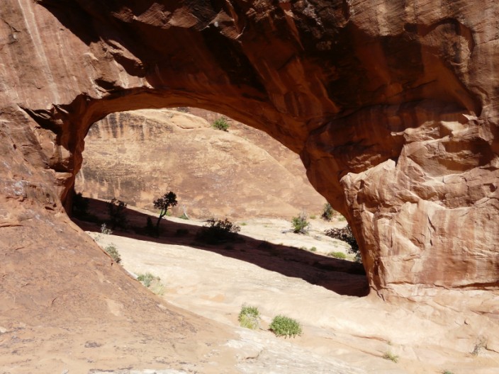
Partition Arch frames the distant landscape . . .

better viewed from the other side . . .

and looking back to Partition Arch

Walking along a rocky ridge provides views down valleys bordered by fins

From Black Arch viewpoint it is difficult to pick out the arch . . .

but it makes a good spot for a photo

Continuing across rock . . .

Double O Arch comes into view . . .

and you can walk through the lower arch for a better view (and a lunch stop)

Heading off along the path . . .

we pass a 'Prickly Pear nursery' . . .

with un-named arches on the way . . .

to Private Arch

From the end of a rocky ridge we can see people on the route we followed earlier . . .

and straight ahead lots of fins . . .

which provide the backdrop for another photo

The way back along the ridge looks steeper than when I walked down it!

Returning along the same route . . .

it looks different the opposite way round . . .

but this rocky descent hasn't changed . . .

it just has a lot more people on it now . . .

including a party of school children

More fins on the way back

Dead Horse Point as the sun begins to set . . .

and it is difficult to know . . .

which is the best view . . .

and which photos to keep

The Colorado bends backwards and forwards . . .

and just as the sun starts to disappear . . .

the camera takes a remarkable shot - not visible to the naked eye

Finally the sun has disappeared below the horizon . . .

but there is still time for a final shot